HOME | BOOSTER | CEMETERIES | EDUCATION
| GHOST TOWNS
| HEADSTONE
MINOTTO
| PICTURES
| ROADS
| JACK SWILLING
| TEN DAY TRAMPS
SUPPORT APCRP - BECOME A BOOSTER
Internet Presentation
Version 041808
Second Edition 051910

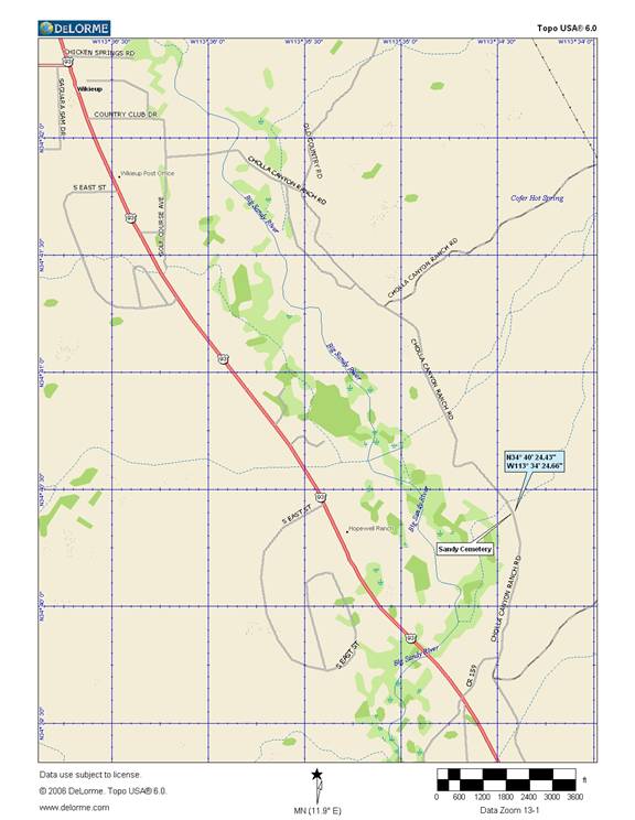
Wikieup,
By: Pat Ryland
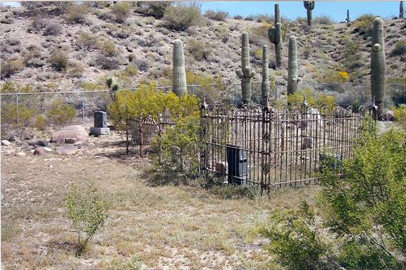
Photo by: Pat Ryland
My historical interest and pursuit lead’s me to books about
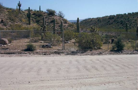
Photo by: Pat Ryland 04/08/08
I went to the
While I was there the owner of the cemetery land, Dale McGhee, stopped by for a chat. He lives just one block north of the cemetery on the same side of the road. He didn’t know anything regarding the graves.
Dale
McGhee is the owner of the
I had the dowsing rods in my hand so I explained the theory
of their use and even was brave enough to show him how they worked on one
marked and one unmarked grave. He was extremely interested in our research
techniques. He said he was a
Further research on the
CEMETERY OBSERVATION
As we have learned in our historic meandering in cemeteries
there is a wealth of information that can be gained by taking the time to
identify and observe clues. Not 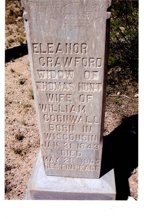 always are grave obvious. Sometimes the only
thing that marks a grave is one or two rocks giving indication there may be a
grave below. At other times it’s a
depression in the ground that the earth has settled. This is most often
interpreted by untrained observers as graves being disturbed. 99.9% of the time
the interred is still interred based on our research.
always are grave obvious. Sometimes the only
thing that marks a grave is one or two rocks giving indication there may be a
grave below. At other times it’s a
depression in the ground that the earth has settled. This is most often
interpreted by untrained observers as graves being disturbed. 99.9% of the time
the interred is still interred based on our research.
Some circumstances are even comical as is the case on this marked that obviously one of the families didn’t agree with “Widow of Thomas Hunt” and tried to chisel off the statement, doing a fairly good job getting the text removed.
We took the liberty to photographically enhance the text to make it more legible to the viewer. Take time when you walk a cemetery, you will be amazed the historical information you can gain.
Photo courtesy: Pat Ryland 04/08/08
History of
Part of one of
The settlement of the white men pushed both tribes farther from their source of livelihood. This resulted in several disputes between the white men, the Yavapai Apaches, and the Hualapai’s. In one of these disputes, two white girls were abducted. The white men laid the blame on the Mojave tribe but they found out after two years that the girls were taken by the more savage Apache Indians. Sold the girls (Mary Ann & Olive Oatman) to the Mojave’s and were actually treated as part of the chief's family. Mary Ann stared to death but Olive survived.
The white settlers and the Mojave’s coexisted in the area that is why it is common for a person from Mohave County to have a mixed heritage. The Mohave's and Hualapai's also fought if one got in the others territory. The name Mohave County was chosen by the Legislative Assembly of the Territory of Arizona along with Pima, Yuma and Yavapai Counties on Nov. 9, 1864. It was said that "Wikieup" is a Native American or Mojave Indian word for "shelter" or "home." The name Wikieup was chosen because an Indian brush shelter was at a spring near the proposed post office. Other names applied for were Owens, Neal & Sandy. (Reference; Arizona's Names, X Marks the Place by Byrd Howell Granger) (Information provided by: Kay Ellermann, Mohave Museum of History & Arts, Kingman, AZ)
Internet Presentation
Version 051910
WebMaster: Neal Du Shane
Copyright ©2003-2008 Neal Du Shane
All rights reserved. Information contained within this website may be used
for personal family history purposes, but not for financial profit of any kind.
All contents of this website are willed to the American Pioneer & Cemetery Research Project (APCRP).
HOME | BOOSTER | CEMETERIES | EDUCATION
| GHOST TOWNS
| HEADSTONE
MINOTTO
| PICTURES
| ROADS
| JACK SWILLING
| TEN DAY TRAMPS