HOME | BOOSTER | CEMETERIES | EDUCATION | GHOST TOWNS | HEADSTONE
MINOTTO | PICTURES | ROADS | JACK SWILLING | TEN DAY TRAMPS
American Pioneer & Cemetery Research Project
Internet Presentation
Version 010612-2
STODDARD, ARIZONA
By Mark Quigley
APCRP Booster
|
Stoddard,
AZ |
I’ve enjoyed
exploring this historical town several times over the last 30 years. Recently I
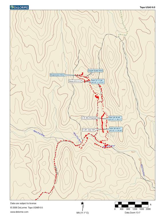
had the pleasure of showing Neal Du Shane, Stoddard. It is located 5 miles
northeast of Mayer on the Agua Fria River. See map below.
A permit from
the State Land Department is required to visit since parts are on State Trust
Land.
|
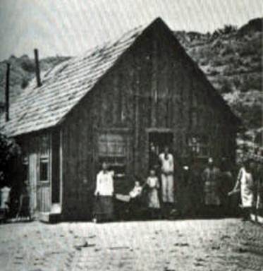
Birdsills Building/house |
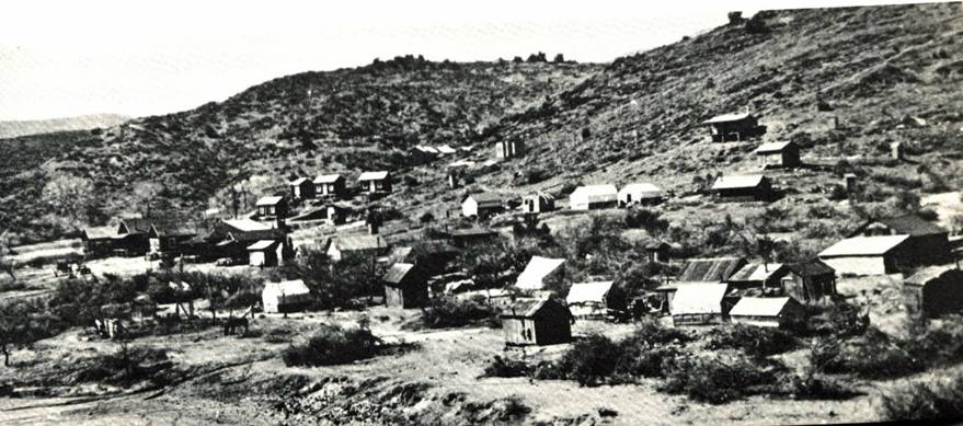
The Town
The original
town sat on the banks of the Agua Fria River that flows year round. Its US post
office began December 15, 1882 and was terminated September 15, 1927. The town
is named in honor of Isaac T. Stoddard. The town had a school, a boardinghouse,
a general store, auto garages, and saloons except during prohibition. Many of
the homes were a combination of tent and board. Its maximum population was 300.
|
Binghampton Mine (left), Copper Queen Mine
(Right) Photo courtesy Bradshaw Mountains.com |
|
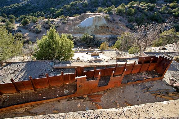
Ore Trough Photo courtesy Bradshaw Mountains.com |
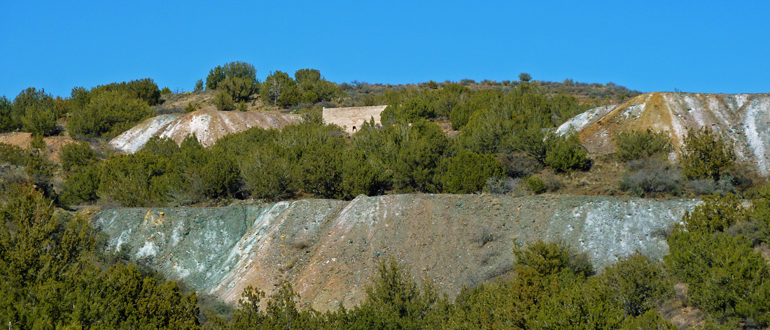
The Mines
Nearby copper
mines supported the town; the most noted mines were the Stoddard, the Binghampton, and the Copper Queen. Most are northwest of
the river and the town. Several are very impressive. Shafts go down to 1000
feet. If you have ever been to Jerome’s museum and seen the displays of
underground mines which traversed all over, Stoddard’s mines are very similar.
By the way if you haven't, it’s worth the visit.
|
Stoddard Smelter/Furnace |
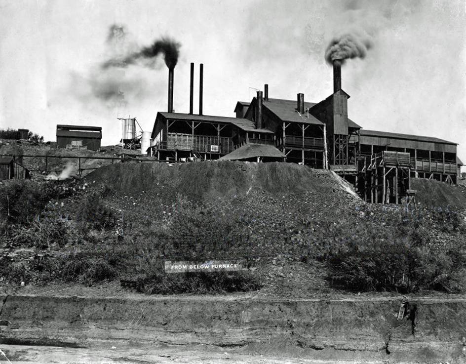
History
reflects two mills were built, unusual for such a small area. Most impressive
was the copper smelter. With the nearby Mayer smelter, it makes one wonder why
investors placed so much value on having another.
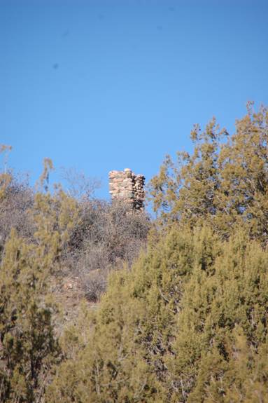
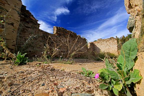
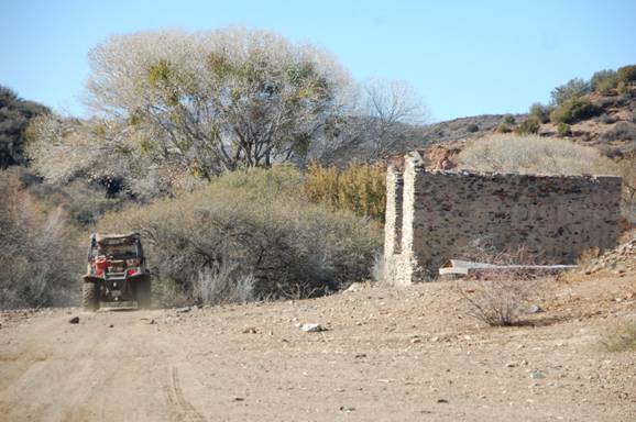
Stoddard Today
A few
foundations remain as well as the old warehouse (Du Shane’s and my
speculations) and other house chimneys in the area. After studying many of the
old buildings’ photographs, most appeared not to have had foundations, but
instead were built quickly on cement blocks. When you walk the area, one
suddenly comes across a pile of nails where a house or a business once stood.
As with most ghost towns throughout the West once they turned "ghosts",
ranchers and nearby townsfolk salvaged all the lumber. This was especially true
during the depression. There is, also, an old meat house built into the
hillside and a couple of water pumping stations hidden along the river banks.
|
Photo
by Neal Du Shane |
Photo
courtesy Bradshaw Mountains.com |
|
Photo
courtesy Bradshaw Mountains.com |
Photo
courtesy Bradshaw Mountains.com |
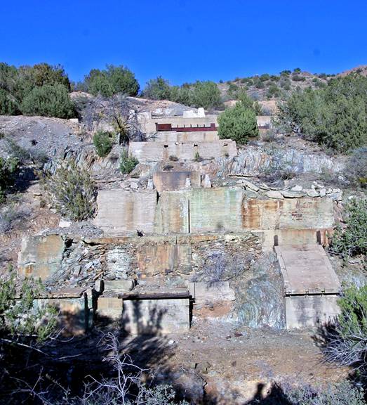
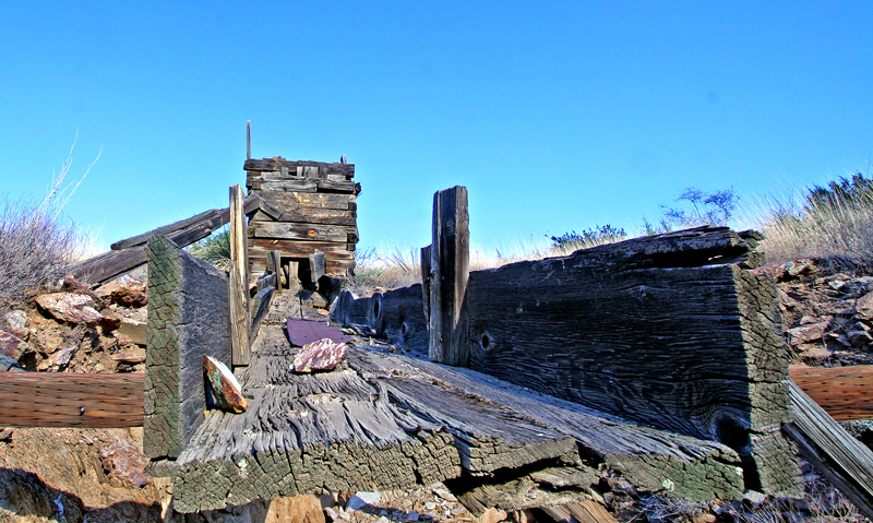
Mines Today
Mines are
literally everywhere around Stoddard. There are several locations that I
recommend visiting. First, the impressive slag piles. They fill an entire
canyon with pure white sand as if hauled in from White Sands National Park.
Slag was a by-product from the nearby smelter, made up of metal oxides and
silicon dioxides. It’s not wise to breathe this stuff so travel slowly when
crossing. Second, the smelter area is worth a visit as well as the two mill
sites. There is, also, an old wooden shoot that still stands. See map for
locations.
|
Store or warehouse at Stoddard Photo courtesy Bradshaw Mountains.com |
Exterior, same store or warehouse at
Stoddard Photo by Neal Du Shane |
|
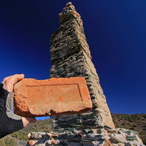
One of several residential chimneys
in area and fireplace brick Photo courtesy Bradshaw Mounatins.com |
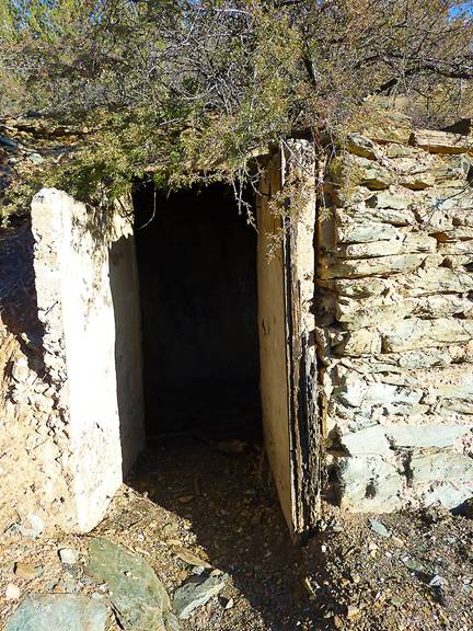
Possible food or dynamite storage
area Photo courtesy
Bradshaw Mountains.com |
|
M=Male, A=Adult, H=Hispanic Three of a possible five graves identified By
Neal Du Shane |
Graves
Du Shane
speculated that because of Mayer's close vicinity, the dead may have been
buried in the official cemetery. He also speculated that others were just
buried out back of the residences. He concluded both to probably be the case
and located a total of 5 graves behind homes. No official graveyard could be
found.
After World
War I ended in 1918, the need for cooper declined. Finally in 1927, the town
post office closed. Stoddard became a ghost town, but had a brief comeback
during the years of 1945 to 1950.
During the
last 5 years much of the Stoddard area has been mined for landscape rock. I
recommend visiting Stoddard in the fall or winter months. During summer
monsoons and spring runoff the Agua Fria River can suddenly flood, and one has
to cross it to get to Stoddard.
Click here to
see more images of Stoddard from Mark's website... www.BradshawMountains.com
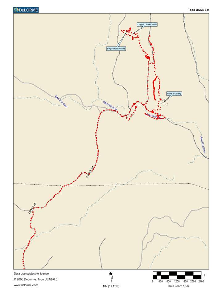
Red dots on map indicated area we
traveled. By Neal Du Shane
Visit our website...
American Pioneer & Cemetery Research Project
Internet Presentation
Version 010612-2
WebMaster: Neal Du Shane
Copyright
©2012 Neal Du Shane
All rights reserved. Information contained within this website
may be used
for personal family history purposes, but not for
financial profit or gain.
All contents of this website are willed to the
American Pioneer & Cemetery Research Project (APCRP).
HOME | BOOSTER | CEMETERIES | EDUCATION | GHOST TOWNS | HEADSTONE
MINOTTO | PICTURES | ROADS | JACK SWILLING | TEN DAY TRAMPS