HOME | BOOSTER | CEMETERIES | EDUCATION
| GHOST TOWNS
| HEADSTONE
MINOTTO
| PICTURES
| ROADS
| JACK SWILLING
| TEN DAY TRAMPS
Internet Presentation
Version 072608

Little has been recorded regarding
Evidence for the existence for Minnehaha, Lapham and
Minnehaha Flats are still visible, however becoming fainter with the passing of
time. Only the unidentified and unmarked
In the Shelley cemetery there were 80% female graves with only 20% male graves. This is not typical of ghost town mining communities. Normally males would represent 90% to 95% of the graves in the cemetery. Often children represent a high percentage do to epidemic’s and poor drinking water.
We have found information that tells us there was a ranch here by the name of the Shelley Ranch. But nothing has been found beyond this.
Adding to the confusion, in the beginning town sites by the name of Marion and McCormick which were named after and editor and ex-governor were first platted. No growth came to either town site as the most structure that was ever built numbered one in each community.
A member of the famous Joseph Walker party, one Charles Taylor recorded several claims. By May 21, 1875 had his own ranch and had taken up residence on Minnehaha Creek in the Minnehaha Flat area. It is believed the name Minnehaha was derived from a mine by the same name.
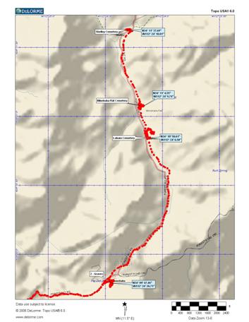
The Minnehaha Flats area got its start with the mining boom at the Tiger Mining District in 1981.This approximately two mile length of roadway was referred to as the Minnehaha Flat’s. Comprising the ghost towns of Shelley to the North, Minnehaha Flat, Lapham then Minnehaha to the South. Numerous mines dot the landscape with the most visible today is the Button Mine.
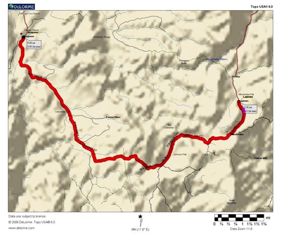
Route from ghost town of Wagoner to Lapham
WARNING: SMALL, 4 wheel drive vehicle road in 2008 – each storm will change the road conditions. CJ-5 size vehicles are fine anything large may sacrifice body parts.
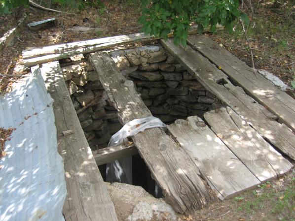
There is a well here which would suggest it was an important town in its day.
There are remains of mining equipment strewn and abandoned on and near the property. We found no adits, or shafts with any depth and no open pit mining – maybe everything was placer mining at this town.
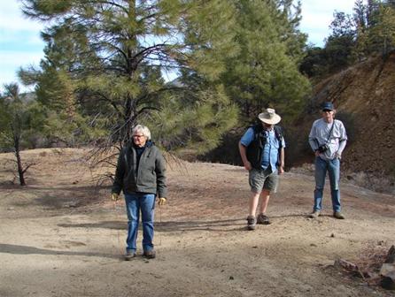
L-R: Mary Ann Wunderlin, Neal Du Shane marking grave, Kevin Hart
in
Photo Courtesy: Bonnie Helten
Be cautious as there are deep well’s along side the road that is very dangerous.
Please leave Historic Lapham as you found it, take only pictures and memories.
Todd Zuercher
7/25/08
Went out today on my day off to survey some of the fire damage in the Crown King area (as much as you are allowed to access, anyway). Much to my dismay, I discovered that a cabin of some friends was one of those destroyed by the fire. A trailer was there, though, indicating that perhaps they might be thinking of rebuilding. I haven't talked to them since they came back to the area.
Headed west and down to Minnehaha from the
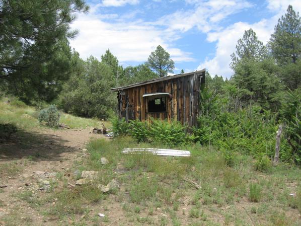
House near Ghost
Photo courtesy: Todd Zuercher 7/25/08
Thankfully, it was. I've attached some photos of it along with what appears to be an interesting well located about 100 ft. from the cabin. The cabin was originally wood but now has sheet metal siding covering most of it. Not a whole lot inside but you can tell people have stayed there at various times over the years. Some foundations nearby of an old fireplace and outbuilding and a fairly large "can dump" which tells me people have spent some time there in the past.
Well at Ghost
Photo courtesy: Todd Zuercher
Walked down the road past the shack, saw a collapsed water tank and a few spots where very old refrigerators, bed springs, etc. were laying. Judging by their appearance, I'd say that stuff was from the '50s-'60s. I don't think there was ever much of a settlement, if any, there other than perhaps a ranch. I found one spot that I thought *might* be a grave so I walked back to the truck and "got the rods" (they always travel with me now on my forays). Didn't come up with anything. I looked around the whole time I was there, thinking about where there might be graves but couldn't find anything obvious or discernable.
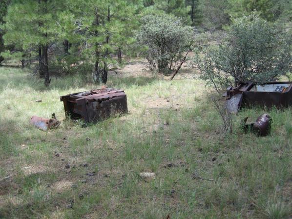
Scattered contents of house in Ghost Town of Shelley, AZ
Photo courtesy: Todd Zuercher 7/25/08
If you have information on
Internet Presentation
Version 072608
WebMaster: Neal Du Shane
Copyright ©2003-2008 Neal Du Shane
All rights reserved. Information contained within this website may be
used
for personal family history purposes, but not for financial profit of any
kind.
All contents of this website are willed to the American Pioneer &
Cemetery Research Project (APCRP).
HOME | BOOSTER | CEMETERIES | EDUCATION
| GHOST TOWNS
| HEADSTONE
MINOTTO
| PICTURES
| ROADS
| JACK SWILLING
| TEN DAY TRAMPS