HOME | BOOSTER | CEMETERIES | EDUCATION | GHOST TOWNS | HEADSTONE
MINOTTO | PICTURES | ROADS | JACK SWILLING | TEN DAY TRAMPS
Internet
Presentation
Version
120612-1
OATMAN MASSACRE GRAVES
and FOURR RANCH
CEMENTERY
By: Neal Du Shane
Contents
What is Known of the Massacre and Gravesite at Oatman
Flat
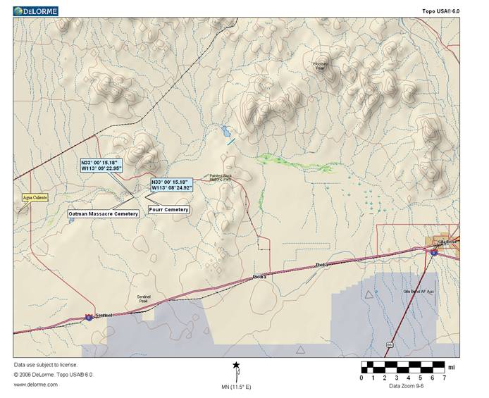
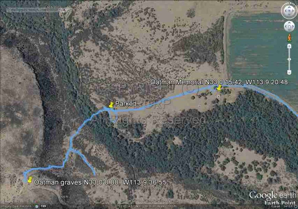
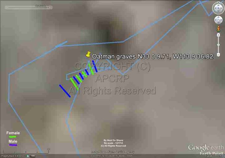
Map from
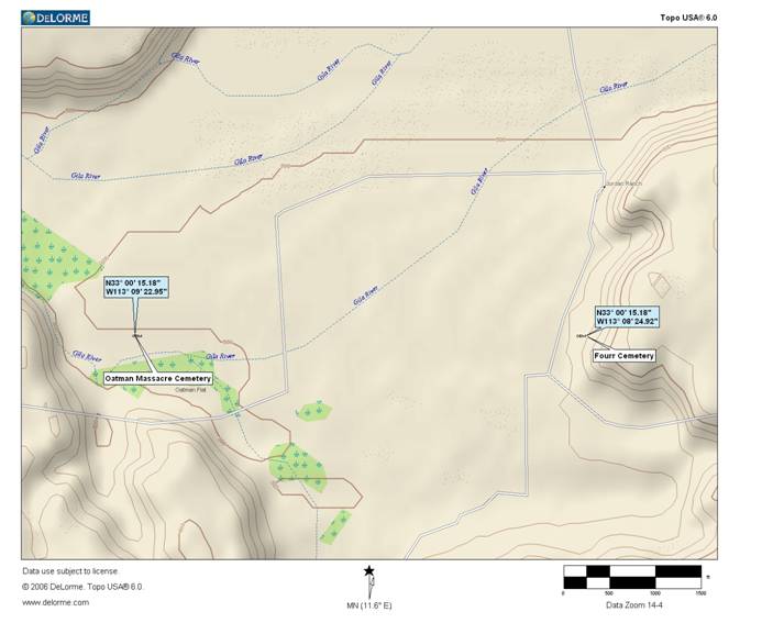
Close-up Map to the
Oatman Massacre and
Members of the Oatman family
involved in the Massacre
|
Royce Boise Oatman, Male 48 Years
Old. Born 1809 Middletown Springs, Rutland, Vermont, Died March 19, 1851 Yuma
County, Arizona. |
Parents
Father Lyman Oatman, Mother Lucy Hartland
Married
to: Mary Ann Sperry, 38 Years Old, Born Feb. 11, 1813, Married 1834 East
Bloomfield, Ontario, New York.
Children
(7)
Lucy
Oatman: Female 16 Years
Old, Born 1835 in Illinois, Died March 19, 1851, Yuma County, Arizona.
Charity
Ann Oatman: Female 5 Years Old, Born
1846 in Illinois, Died March 19, 1851 Yuma County, Arizona
Roland
Oatman: Male 1 Year Old,
Born 1850 in Illinois, Died March 19, 1851
Olive Ann Oatman: Female
66 Years old when she died, Born 1837 in Illinois, Died March 20, 1903, Buried
West Hill Cemetery, Sherman, Grayson, Texas
Lorenzo D.
Oatman: Male 65 Years old when he
died, Born 1836 in Illinois, Died October 8, 1901, Buried Red Cloud, Webster,
Nebraska
Mary Ann Oatman: Female
10 Years Old, Born 1843 in La Harpe, Hancock,
Illinois, Died March 19, 1851 Yuma County, Arizona
Royce
Oatman Jr.: Male 11 Years Old,
Born 1840 La Harpe, Hancock, Illinois, Died March 19,
1851 Yuma County, Arizona
----------------------------------------------------------------------------------------------------------------------------
What is Known of the Massacre and Gravesite at Oatman Flat
Quote from book written by Hal & Doris Clark who is believed to be related to the Oatmans. Chapter 14- “What
is Known of the Massacre and Gravesite at "Oatman
Flat":
The bones were buried 3 times according to her story, but this is what she
says:
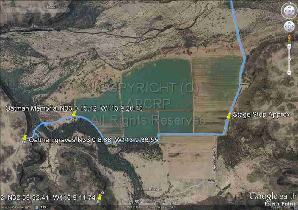
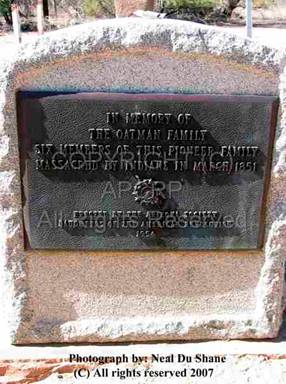
“The Oatman Massacre Gravesite is located Township 5 South, Range 9 West, Section 11, Lot 2 on the south side of the Gila River. A fee patent issued To the National Society of the Daughters of the American Revolution, according to the Act of Congress approved 15 June, 1926, was executed on 12 January 1954 by the Bureau of Land Management. The area described contains 1.00 acre in which is situated the common grave of the Oatman Family”. The original burial of the Oatman family was narrated in a letter of Mrs. Wilder to her father, quoted in "The Olive Branch" Sept. 1851: "While we tarried here (Mericopa Wells),(sic) Willard and Robert Kelly went down to Oatman's wagon....to bury the dead." In the journal of Maj. Heintzelman while at Fort Yuma under date of Sat. March 8, 1851:"When I got back I learned my men have returned from their search after the distressed emigrants. They found the wagon diverted over a hundred feet from and two dead bodies, covered over with large stones. One they took to be a man but could not decide about the other. There was nothing of an consequence left in or about the wagon. In the Florence Arizona Enterprise for 13 June 1891, Mr. Charles D. Poston said: "In after years I was passing Oatman Flat with a train, and stopped long enough to gather the bleaching bones and inter them in one grave which was surrounded with pickets." This gravesite has been noted and described by a number of desert travelers during subsequent years. One of these was Mr. Waterman L. Ormsby the only through passenger on the first westbound Butterfield Overland Mail Stage in 1858: "The graves of the father and mother are directly in the road, and the teams often pass over them. They lie some distance from the scene of the murder, which took place on a hill half a mile off. Mr. Jacobs, the road agent on this section of the line, intends having the graves enclosed with a fence so as to turn the road aside."-----------------------------------------------------------------------------------------------------------------------------
December 6, 2012 Update
|
|
|
Incorrectly
identified by many over the years as
the Oatman’s grave site |
There
were no graves found at or near this Memorial. The actual Oatman
family graves are one third of a mile to the west on top of the bluff |
After 150 plus years, much has been
written regarding this historic encounter of the Oatman family. Nothing has
been written or documented that the Oatman family defended themselves in any
way, not even one shot but then why is there one extra male grave? Could it be
the Oatman’s got off one shot before or during the massacre? Or was this person
killed before and this action caused the massacre? Or did this person parish as
a traveler and was buried with the Oatman’s in later
years? Reading the various articles, several things don’t seem logical and
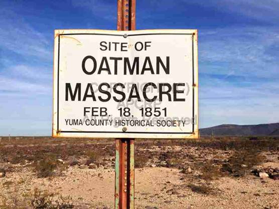
conflict with each other. Case in point: what is the date of the massacre? Some
articles and plaque at the memorial say March 19, 1851 while the sign at the
massacre site put up by the Yuma County Historical Society says Feb. 19, 1851.
As with most if not all, historical research, often there are more questions
than answers. We have found there is no clear factual accounting of history,
rather what people remember and these remembrances very greatly. Who is to say
what is written or repeated in relationship to history
is accurate and factual, the primary reasons seem to be Bias, Urban Legend and Old Wife’s Tales.
|
|
|
|
|
|
APCRP subscribes to the belief you
can’t set in an office behind a desk and write history; potentially all you do
is repeat inaccuracies as previously written. It is critical to actually
physically visit where the events took place, stand and observe the
surroundings, searching for any clue that may resolve unanswered questions.
Granted surroundings can and do change over the years but mountains remain constant.
Thus was Certified APCRP Coordinator Gary Grant and
Neal Du Shane’s sojourn after compiling and reading all the written information
regarding this event, to actually witness the area to observe it for ourselves.
|
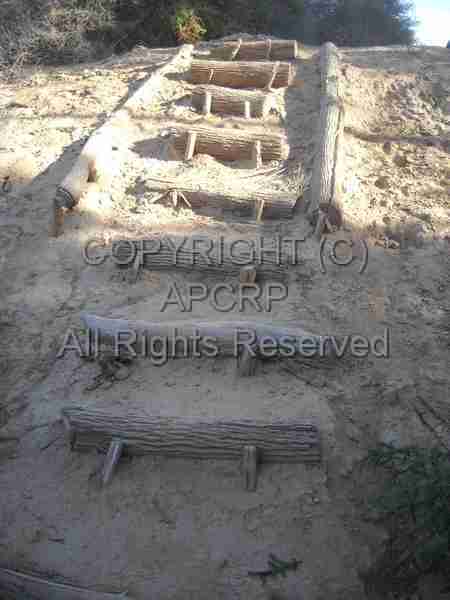
Steps
to/from the river bottom trail Photo
courtesy: Gary Grant |
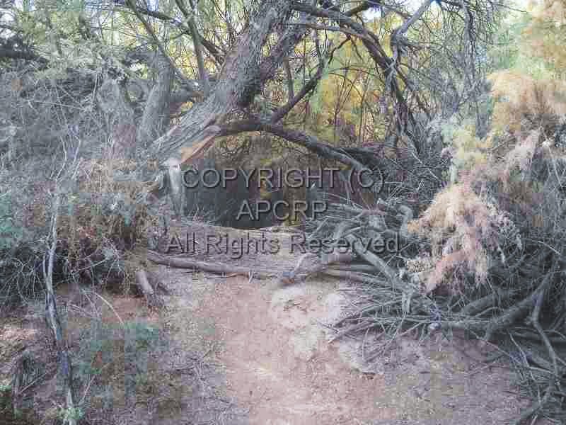
Hobbit
environment on the hiking trail Photo
courtesy: Gary Grant |
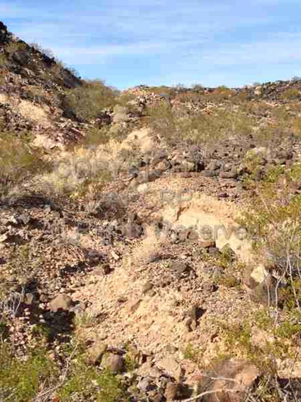
After we stopped and researched the
old Fourr Ranch and the Fourr
Cemetery (1868) near the location of the original Stage Stop (operated from
1857-1861) we observed the old road from the east coming off the east bluff
down into the valley. We traveled to the Oatman Memorial, and then traveled as
far as we could go with a vehicle on the road west. Parked, walked down some
crudely made wooden spike steps and hiked through what Gary called a nifty
Hobbit environment for several hundred feet, then followed the path of fellow
historians in search of the Massacre site from the North and East side. There
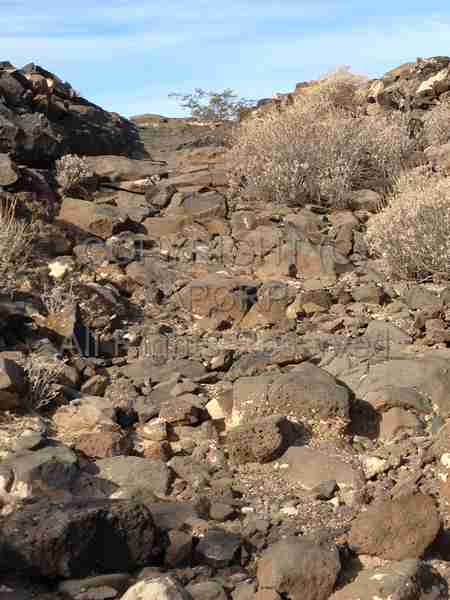
is a four wheel drive road a.k.a. trail that comes in from the south that we
could see at the Massacre site. It was not too difficult foot path but would be
advised to not take it if you have limited mobility or if it has recently
rained as the soil could be muddy and the lava rocks would be slippery. Combine
the mud on hiking boots with the slippery rocks and the results would not be
pleasant. I was amazed at the amount of footprints on this route, while not an
official hiking trail it was well used by interested parties searching out this
historic site.
|
|
|
|
|
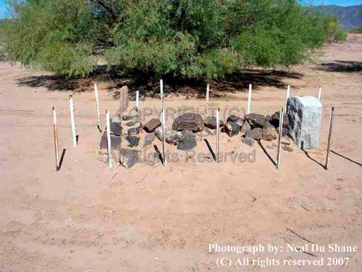
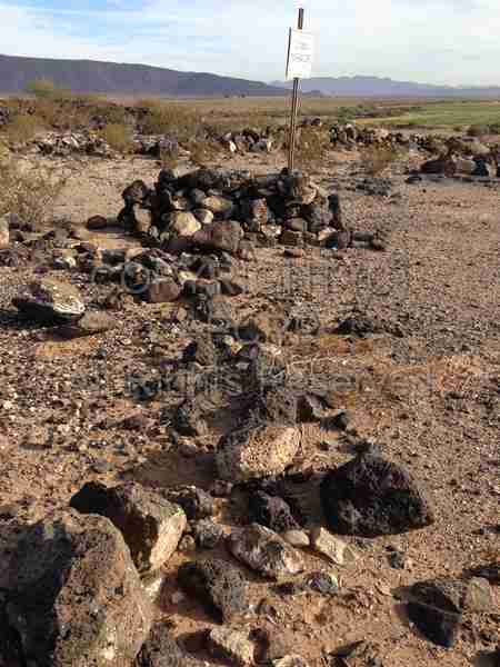
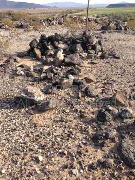
Our research revealed two of the
members were killed with arrows (Mr. Oatman and one child) and one person was
knifed to death (Mrs. Oatman). It has been written all were clubbed to death
and this could have possibly occurred after the fact. Our research identified
six graves plus one male in almost a straight line from the maker indicating
the Massacre site on the bluff. Extensive research by two Certified APCRP
Coordinators found no graves or burials at or near the memorial down in the
valley – it is just that – a memorial of this tragic event in Arizona History.
|
|
|
|
|
It is APCRP’s belief the
graves/remains are laid out with Mr. Oatman at the Massacre sign below the pile
of lava rock at the most NE grave. Next is Mrs. Oatman in a much less obvious
pile of scattered lava rock, then the one year old Roland, then a girl, boy,
girl, laying in a S. S.W configuration. Unexplained is another male grave about
4 feet from the others at the end of the row, but in the same configuration as
the others. Research was completed within 200’ of Mr. Oatman’s grave site but
no other internments were found or identified. We found nothing indicating a
mass grave either at the Massacre or Memorial site. It was written above, that
the graves were in the middle of the road at that time, depending how the old
road traversed this area this could have been possible. Currently no bones or historical
artifacts were visible at or on the surface. We speculate they would have been
above ground graves by piling rocks on top of the deceased. The best preserved
and obvious is Mr. Oatman’s grave. The elements and wild life are potentially
responsible for scattering the lava rock from around the remaining grave sites.
It is unlikely the Oatman’s fell and died in a
straight. Likely someone did move the remains to a central location and laid
them out in a straight formation, so it would seem logical they were moved at
least once from the spot where they died.
|
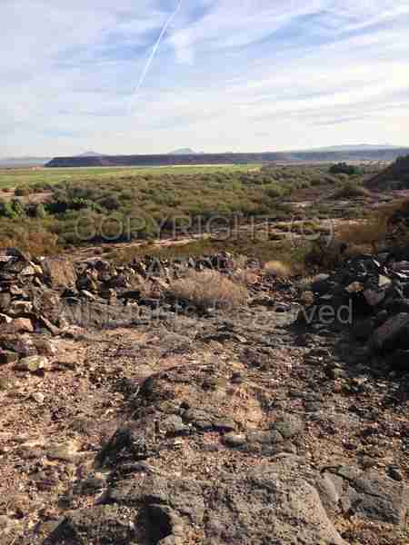
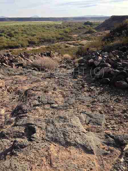
Looking up the
former road from the river bottom |
The historic road, later referred to
as the “Stage Road”, to the top of the cliff from the river bottom is
approximately 700 feet in length with an elevation gain of 75 feet,
representing a 10.7% grade. While this is a fairly steep grade, one needs to
factor in the soft clay earth at the bottom and the solid lava rock with a
stair step effect for the last half of the climb up the incline, this was a
tough pull for the teams of horses or oxen that had to navigate up this grade.
Interesting to observe near the top of this road/pass you can still see the
wear ruts in the rocks from the wagon and stage coach wheels traveling this
route years ago leaving a historical lasting impression in the rock. Which
clarifies this was an extensively used route by travelers as a major East/West
road. After 1858 stage coaches could have passed by here at least daily from
either direction for approximately three years.
Currently the lower end of this road
has been completely washed out and only accessible by hiking as no vehicle can
access it at the lower end (River bottom) and can no longer travel up or down
it in either direction.
All opinions shared are the beliefs of
the researchers. Nothing was disturbed at the site, no rocks overturned or
moved. No earth moved, to come to our research conclusions, only foot prints
were left and photos taken joining the many others that have respectfully visited
this historic site.
|
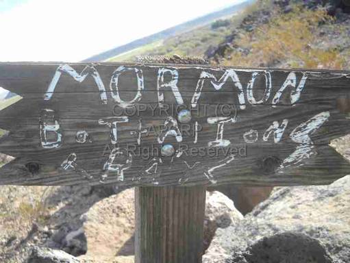
It
is believed this sign reads: "MORMON
BATTALIONS TRAYL (sic)" Photo courtesy Gary Grant |
All photos except those noted,
are by the Author
American Pioneer & Cemetery Research Project
Internet
Presentation
Version 120612-1
All
Rights Reserved – © 2007 - 2012 APCRP
WebMaster: Neal
Du Shane
Copyright
©2003-2011 Neal Du Shane
All rights reserved.
Information contained within this website may be used
for personal family history purposes, but not for
financial profit or gain.
All contents of this website are willed to the American
Pioneer & Cemetery Research Project (APCRP).
HOME | BOOSTER | CEMETERIES | EDUCATION | GHOST TOWNS | HEADSTONE
MINOTTO | PICTURES | ROADS | JACK SWILLING | TEN DAY TRAMPS