American Pioneer & Cemetery Research Project
Presentation
Version 021113
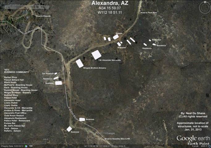
ALEXANDRA, ARIZONA
NOTE: Contrary to previous historical writing by Tom Barkdull and other historians, that was believed to be accurate based on previous historian’s research, the physical location of the original Alexandra has been documented and it isn’t where previously thought. Most photographs and historians imply Alexandra was on the South side of the mountain very near the Swastika Mine, nestled slightly below the main horizontal adit of the mine, approximately one third of the way down the mountain’s south side. It is possible with the constant legal confrontations and bickering at the Peck Mine, production slowed, people and the Post Office at the original Alexandra was relocated over and down the mountain, closer to the Swastika Mine. To date we have found no documentation of this happening only speculation.
Regardless, in actuality the original historic Ghost Town of Alexandra is situated to the north of the pass going over the mountain, at and/or near the junction of the driveway leading to the Peck Mine. What was referred to as “Swastika Mine Road” in those days or identified currently as “Forest Service 89 Road”.
For years I’ve visited the Swastika Mine, standing with the photo of Alexandra in hand and could never match the photo to the beautiful landscape and breathtaking view.
Some years ago on a sojourn to visit Virgil Snyder at the Peck Mine, I was leaving the Peck Mine and in the process of closing Virgil’s gate, glancing up I instantly recognized the intersection in the photo. I immediately returned to Virgil who has resided in this general area for 30 years or more and got the expression “everyone knows where Alexandra is”! Obviously many people didn’t including many historians. Possibly one of those “Urban Legend” situations where an inaccuracy has been repeated so many times over the decades, people believe it as factual. It has happened to all historians in researching history.
The Gladiator Fire in 2012 cleared the landscape in and about Alexandra that had previously been overgrown with bushes. The fire cleared the greenery making the flat lots of Alexandra visible with the garbage dumps for most structures exposed. Using the only known original historical photo of Alexandra we duplicated the location and documented the exact location comparing it to the landscape and photo for which it resided.
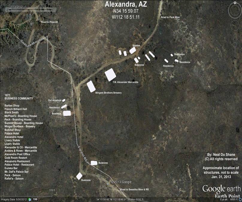
Presented in this recreated satellite image of Alexandra, is the estimated location of most of the homes and businesses (but not all) based on the historical photo of Alexandra that comprised the community in 1877?
Neal Du Shane
|
2013 Satellite Recreation of historic Alexandra, AZ Created By: Neal Du Shane © 2013 All Rights Reserved |
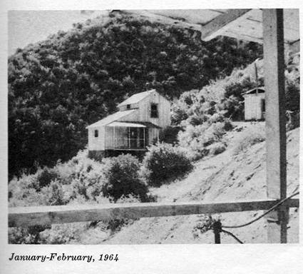
From “True West Magazine – January-February, 1964
ALEXANDRA
By Tom Barkdull
Photos by author
First in a series of little-known ghost towns untrammeled by tourists and weekend explorers. Directions are clear and all you need is a four-wheel drive, stamina and a longing for yesterday.
Perched precariously on the steep slope of Peck Canyon in Arizona’s Bradshaw Mountains broods the old and forgotten town of Alexandra. Named after the wife of one of the owners who laid out the town site. Alexandra flourished as a mining community during that lusty era from 1873 to 1896.
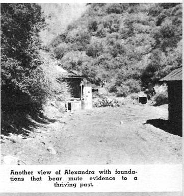
Today there remain eleven of the ancient houses which eighty years ago were bright with light, gay with laughter, and warm with human companionship. Their windows are now gone and their doors hang from rusty hinges. The whispering wind scampers across the verandas, through the open doors, and rustles the faded wallpaper in the empty rooms.
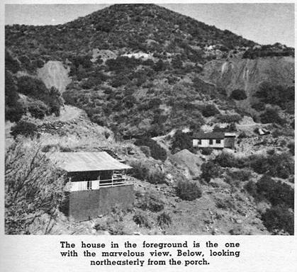
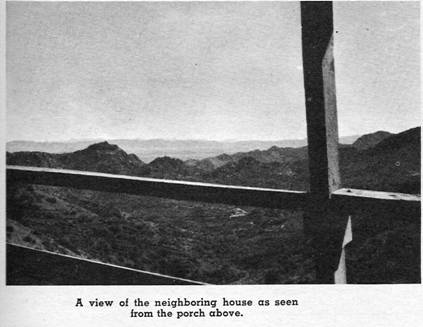
Anchored to the side of the canyon, and accessible down a flight of rickety wooden steps, the pride of the village still stands. Vacantly but proudly this house gazes with reminiscence over the worked-out mines below. It will probably be your favorite, as it is mine, with its wide roofed porch hanging dizzily but securely a sheer thirty feet above the canyon floor. From this porch you will enjoy a panoramic view unsurpassed anywhere in the state. For a hundred miles there is nothing to mar the beauty of the mountains and high desert until they merge into the haze of the far distant horizon.
The mines are dead – the miners are gone – but near the center of town three tunnels still open into the canyon wall. These are all that remain of the operation which reportedly produced over $1,000,000 in silver for its owners. Twisted, buckled, narrow gauge rails lead into these portals and disappear into the gloom.
Alexandra lies a mile off the road between Mayer and Crown King. Four and a half miles after passing through Cleator, look to your right; high on the mountain slope, near the horizon, the old buildings are clearly visible. Attempt the rocky and rugged road to the actual town site only if you are equipped with four-wheel drive. For those who do go all the way, I promise an unequaled glance into Arizona’s romantic past.
|
|
|
|
|
|
|
|
|
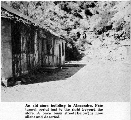

Editors Note: The only remaining building in the summer of 2005 was an old Store Building described in the above photo. Interestingly it was still being used as a retail store by children of the current land owners selling souvenirs of the area. Many foundations remain.
ALEXANDRA
COUNTY: Yavapai
LOCATION: 10 mi. southwest of Mayer
P.O. est. as Alexandra, Aug. 6, 1878: Discontinued March 25, 1896
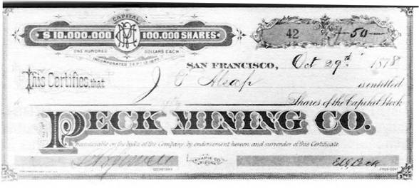
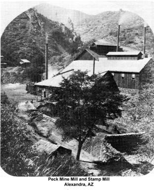
Alexandra owed its existence to the famous Peck Mine. In June of 1875, E.G. Peck, C.C. Bean, William Cole, and T.M. Alexander were prospecting in the Bradshaw Mountains. Stopping to drink from a spring, Peck noticed a peculiar rock. He examined the mineralization, and decided to have the sample assayed. It provided to be rich in silver. The Peck claim was located and work begun.
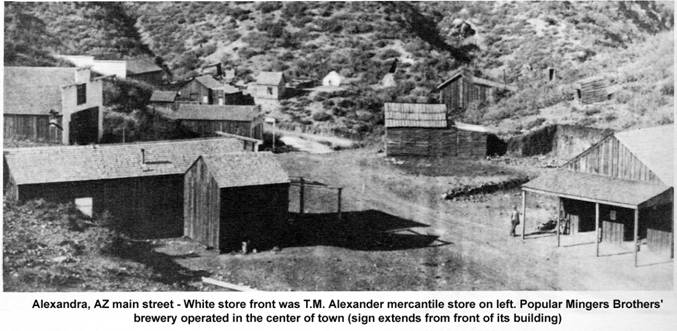
Soon a townsite was laid out in “Peck Canyon” and named Alexandra in honor of Mrs. T.M. Alexander, the first lady visitor to the mine.
A winding mountain road was built to remote Alexandra. Prescott became the camp’s supply depot, mail routes wee established, and the towns-people soon constructed between seventy-five and a hundred buildings. There were stores, saloons, boarding houses, livery stables, a blacksmith shop, a butcher shop, and a brewery.
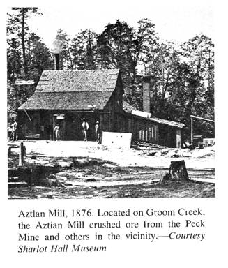
At first the ore was transported by pack train over rugged mountain trails and reduced at the Aztlan Mill. This proved to be both tedious and expensive, since the mill was located some thirty-five miles from the Peck Mine. A ten-stamp mill was installed at the mine by December, 1877, but it never did get much use. As a result of litigation problems which began in 1879 and dragged on and on, the mine was closed. People lived on hope for a while, then left.
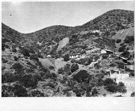
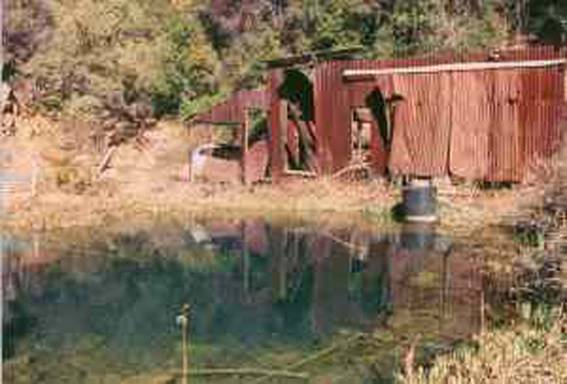
Nothing remains of the former mining camp. A mile east of the Peck Mine and just below the side Alexandra the deserted Swastika Mine Building cling to the mountain slope. These building were constructed during the present century and on occasion have been mistaken for Alexandra.
From: Ghost Towns of Arizona, by: James E. and Barbara H. Sherman
|
|
|
|
|
|
|
2013 Satellite Recreation of historic Alexandra, AZ Created By: Neal Du Shane © 2013 All Rights Reserved |
WebMaster: Neal Du Shane
Copyright ©2003-2013 Neal Du Shane
All rights reserved. Information contained within this website may be used
for personal family history purposes, but not for financial profit of any kind.
All contents of this website are willed to the Arizona Pioneer & Cemetery
Research Project (APCRP).